Upper
Colorado
Difficulty:
Class III
Craft:
Raft
Ducky
Kayak
After Yarmony Rapid:
SUP Board
Canoe
Elevation:
Put in – 6,964ft
Takeout – 6,149ft
Length:
60.3 miles
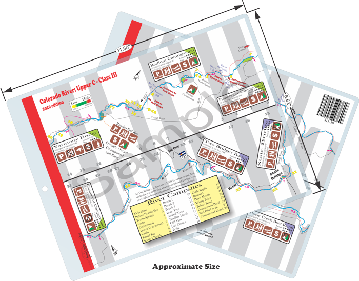
This large size map covers the same stretch of river as the three listed at the bottom of this page, however it is not as pocket sized as the other three maps.
For more details on each individual stretch click on the map cards at the bottom of this page.
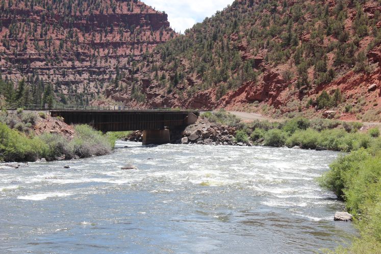
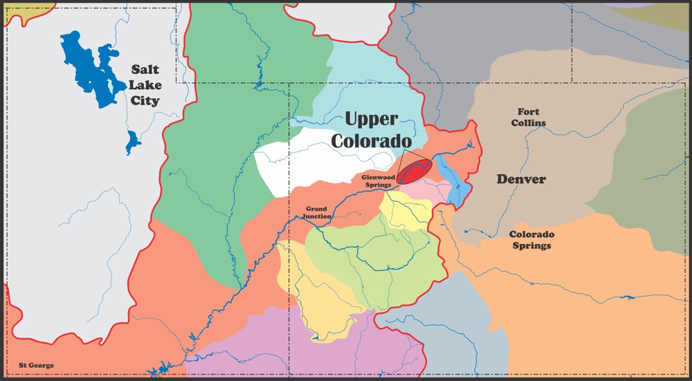
The Upper Colorado, or Upper “C” as it’s known by most river folk, refers to the Colorado River from around Kremmling CO to Glenwood Canyon just downstream of Dotsero CO. It is the second most popular river after the Arkansas with over 90,000 people running this river between Memorial Day and September 30th (according to the BLM website). This stretch is popular for whitewater enthusiast and fishmen alike with over 60 miles of trout fishing and some really fun rapids. Most of this stretch is flat water and the rapids are spread out, in some cases really spread out, but it is absolutely gorgeous.
While most consider Gore Canyon to be the beginning of the Upper C and Bair Ranch to be the end, we focused on the section from Pumphouse to Dotsero for our maps so far. Gore Canyon is on the list of maps to do in the future as is Dotsero to Bair Ranch but there are some other areas we’d like to focus on first.
History
People:
Evidence of man living in this area date back to the Archaic Era after the discovery of a couple of pit houses in 1987 by an archaeologist and his team. The team was conducting a road survey for Eagle County when they came across the pit houses and some human remains dating around the same era, over 7,000 years ago. It is believed that these pit houses were used during the winter months and the people probably roamed high in the mountains during the summer months and returned here in the fall. Construction techniques of the pit houses suggests that older such houses most likely existed and one of the houses is thought to be 300 newer than the other.
Other evidence of early people in the area date back to around 6,300-5,600BCE with a bison butchering site. And some other evidence dating to the Late Prehistoric period (pre-Columbus) around 700 to 800CE with some flaked stone and fragments of ceramic jars and bowls.
This area was also inhabited by the Ute up until the late 1800s when settlers started to move into the area. While there was a lot of hostilities between European settlers and the natives across the country, Chief Yahmonite also called Chief Yarmony worked to keep relationships peaceful. Many things are named after Chief Yarmony and some believe that his final resting place is near the summit of Yarmony Mountain just northwest of Rancho Del Rio.
Starting in the mid-1800s settlers started coming into the area and homesteading. After the silver rush ended in the late 1800s more settlers came down out of areas like Leadville and other high-altitude areas to this milder climate. Most of the people that moved to the area were farmers and ranchers with a few that came to mine for copper and gold though profitable amounts were never really found here.
Railroad:
In 1902 the Denver & Salt Lake Railway began construction in Denver Co with the intention of connecting with Salt Lake City Utah. The D&SL railway was led by noted financier David Moffat who was also responsible for the Glenwood to Grand Junction line and several others while he was president of the Denver & Rio Grande. Sometime after leaving the D&RG Moffat set out to create a direct rail line from Denver to Salt Lake and the line followed much of the Colorado River until the town of Bond before it headed up to Steamboat Springs and then on to Craig. The intention was to head across the Uinta Basin, however, Craig was as far as they completed. Moffat Tunnel and Moffat County, of which Craig is the county seat, were named after David Moffat after he died in 1911.
After his passing the D&SL Railway changed hands a few times before being bought by the D&RG. In 1934 the Dotsero Cutoff was completed connecting the D&SL line to the D&RG line that connected Pueblo to Salt Lake giving a much straighter line between the two major cities. Before this the best way was to get from Denver to Salt Lake was to head down to Pueblo, up the Arkansas Valley, over Tennessee Pass (near Ski Cooper), down through Minturn, then follow the Eagle river down to Dotsero (most of which is no longer in use), then on to Saltlake.
The Dotsero Cutoff and the old D&SL line through the Upper C is still in use by the Union Pacific and while there isn’t a ton of rail traffic when the train rolls through it can be hard to hold a conversation. It’s not too bad though and it could have been worse. Back when they were surveying for the rail line the Bureau of Reclamation and a few companies were in the process of building a dam in this valley before President Teddy Roosevelt sided with the rail road and decided that a rail line was more important than a reservoir. They had already started to tunnel through the canyon wall near Eye of the Needle on the Pumphouse run.
The California Zephyr is the passenger train that runs between Chicago and the San Francisco Bay Area, via Omaha, Denver, Salt Lake City, and Reno. I’m not in any way suggesting that someone do this but it is common practice to moon the Zephyr as it rolls by, not that we condone this behavior.
For more information on the runs on the river please go to the individual pages for each section.
Water sports are inherently dangerous sports in which severe injuries or death may occur.
Do not use this website or maps unless you are an expert, have sought out and obtained qualified professional instruction or guidance, are knowledgeable about the risks involved, and are willing to assume personal responsibility for the risks associated with these activities. If you have any doubts in your ability please stay off the water.
DO NOT USE THIS WEBSITE OR MAPS UNLESS YOU ARE WILLING TO ASSUME PERSONAL RESPONSIBILITY FOR THE RISKS ASSOCIATED WITH THE ACTIVITIES DESCRIBED OR DEPICTED!!!


