Junction
Town Float
Difficulty:
Class I/III-
Craft:
Raft
Ducky
Kayak
SUP Board
Canoe
Elevation:
Put in – 4,644ft
Takeout – 4,537ft
Length:
11 miles
This regular size map covers approximately 11 river miles on the Colorado River in the Grand Valley.
The GJ Town Run is the most popular of the Town Floats in the Grand Valley. There are many options to access the river through here to make it longer or shorter as desired. The run from Corn Lake to Blue Heron takes you through the most exciting features in the Grand Valley but is still mellow enough at lower flows for beginners to have a good time. My Front Range friends have long referred to Junction as a one wave town but with the 29 Rd Wave forming in 2011, I can now inform them that we are a two-wave town and sometimes three when Silo is in. With the new ramp being put in at Las Colonias I foresee Palisade to Las Colonias gaining in popularity.
This stretch can get a little rough at higher flows and beginners should wait for low water to start running it, especially if you plan to run it in an innertube, pool toy, or other craft not intended for running rivers (we often call them “Department Store Coffins”). For the experienced class III boater, this run above 20,000cfs gets to be pretty fun. The wave train leading into the 29Rd Wave and 5th St Wave can be exciting.

Silo Wave:
Silo is a surf wave feature that forms at certain flows. At lower flows an island comes out of the water creating a side channel where a rock forms a hole. At higher flows the island is completely underwater and at much lower flows the rock is out of the water. If one wants to surf it they have to hit it at that in between flow. This can be a fun wave to surf when it’s good but there are several downed trees below it making us only recommend the experienced boaters surf here.
The family that owns the lake directly across Dike Road from the Silo Wave are truly amazing people. They provide access to their lake for programming for a few Grand Valley nonprofits that work with veterans and clients with disabilities including Colorado Discover Ability and Team River Runner. They have also started their own nonprofit, Dream Big Adaptive Water Sports. Dream Big is an organization that teaches adaptive water skiing to clients with all types of disabilities. Along with all this the family is also very involved in Special Olympics. If you happen to run into them while you are playing at Silo make sure to smile and wave and thank them for everything they do for our veterans and the special needs community in the Grand Valley, but don’t tell them I told you, they are very modest people.

Silo Wave when the flow was 6,150 at State Line
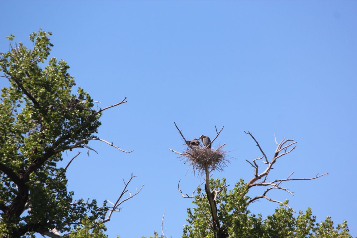
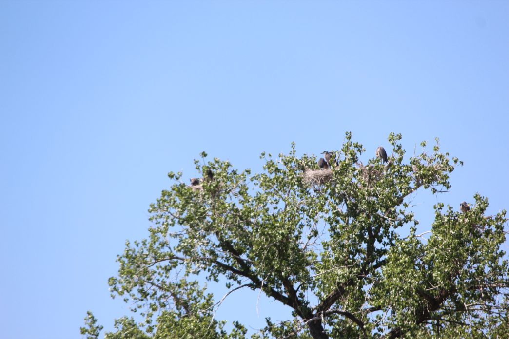
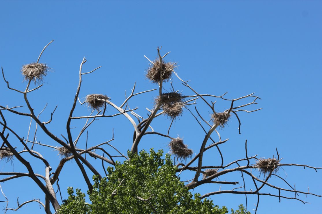
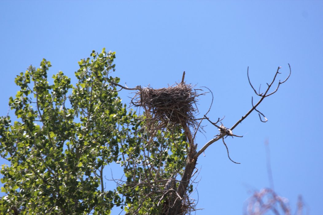
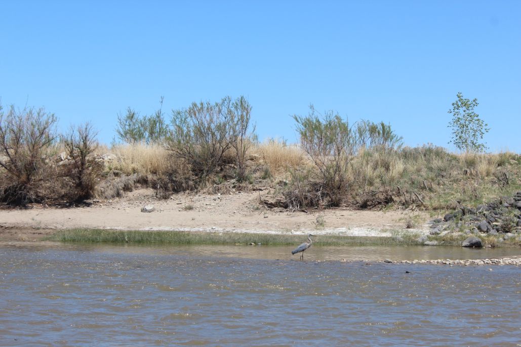
Throughout the season Blue Heron can be spotted all over the river through town. They tend to nest together unlike preditor birds that you might also see along the river.
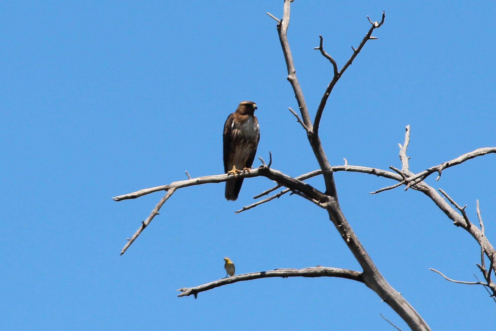
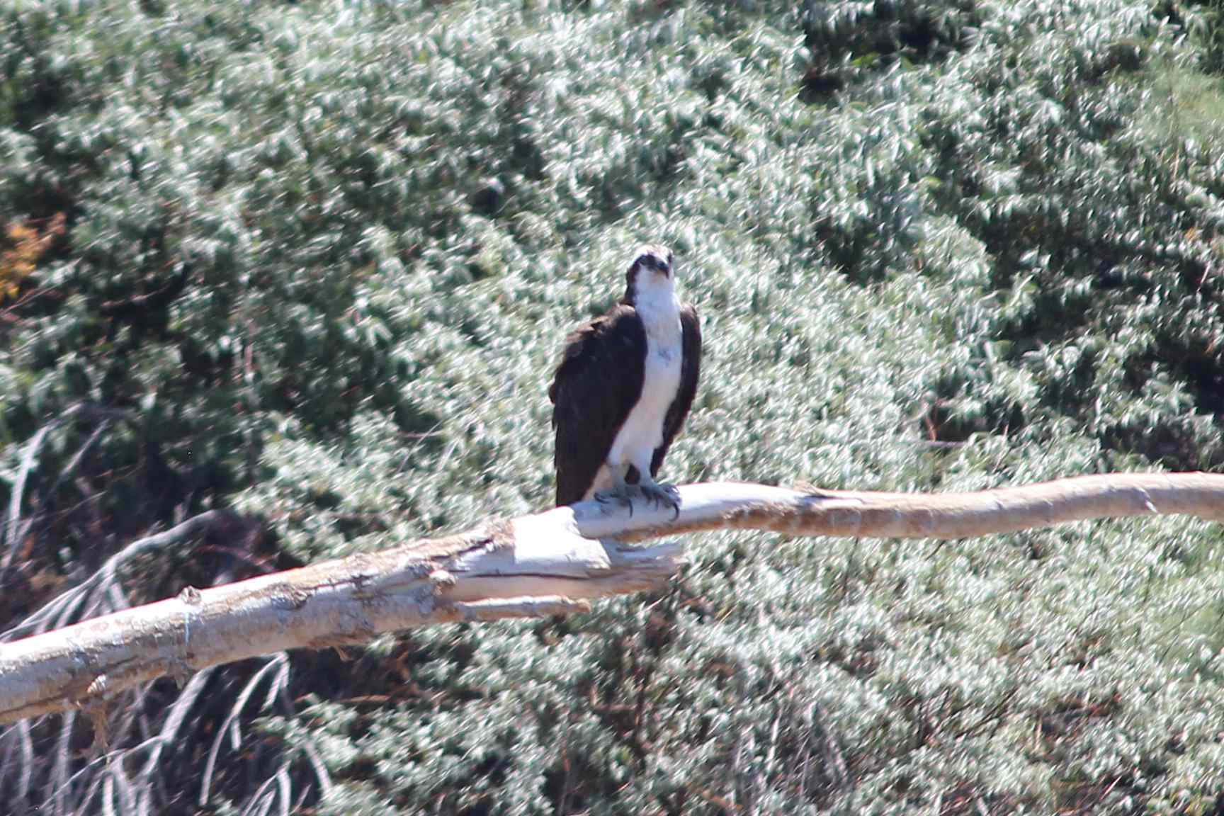
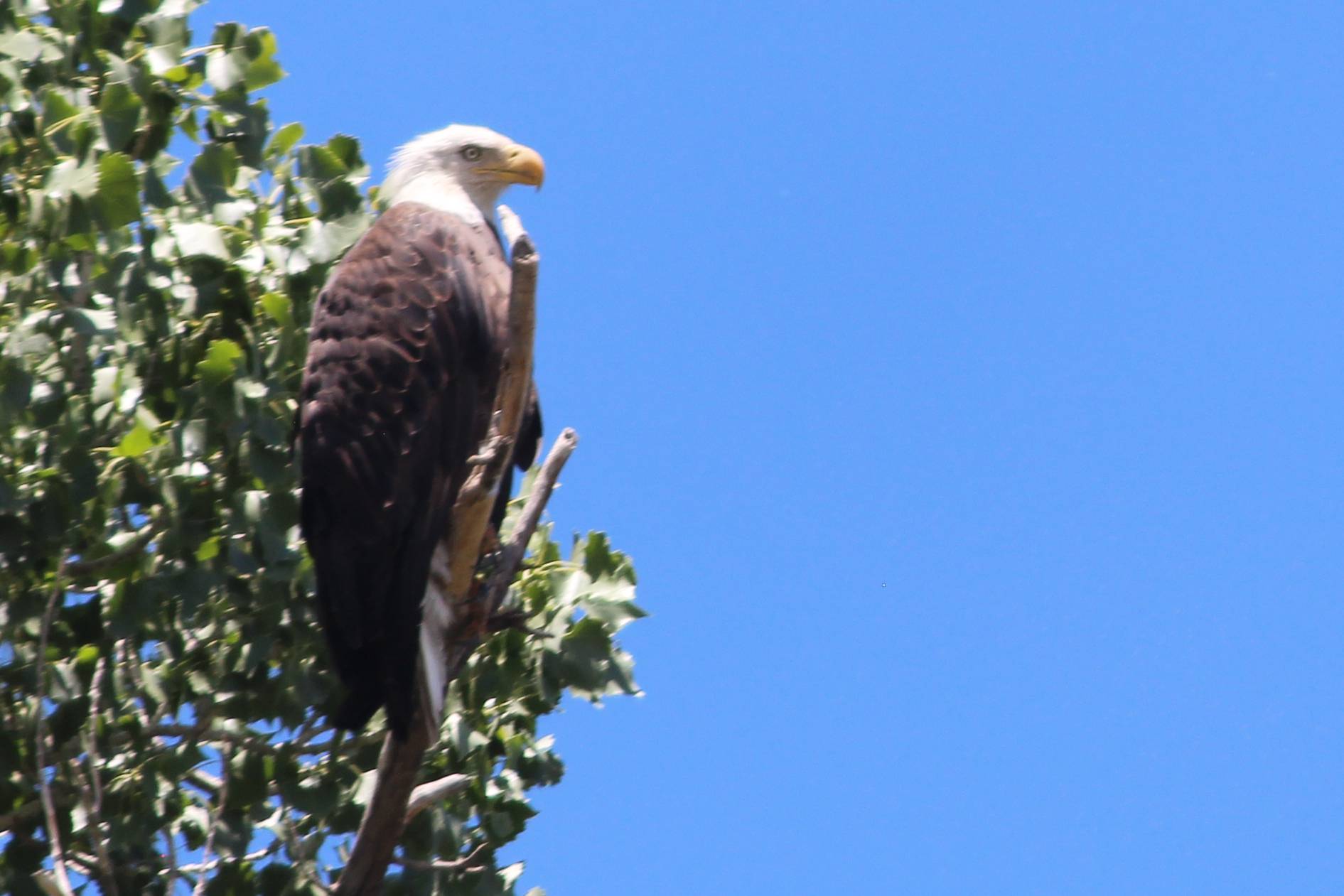
If you look close you can find a verity of raptors along the river through town. I believe the first picture is a golden eagle, the second is an osprey, and the last is a bald eagle. In the last few years I have seen more and more bald eagles along the river which is pretty cool considering the bald was on the endangered list while I was growing up in the 80s. All of these pictures were taken between Corn Lake and the 29 Rd Bridge in June of 2020. They were taken with my telephoto lens, on my DSLR, but we were only about 30 yards from the bald when we passed it.
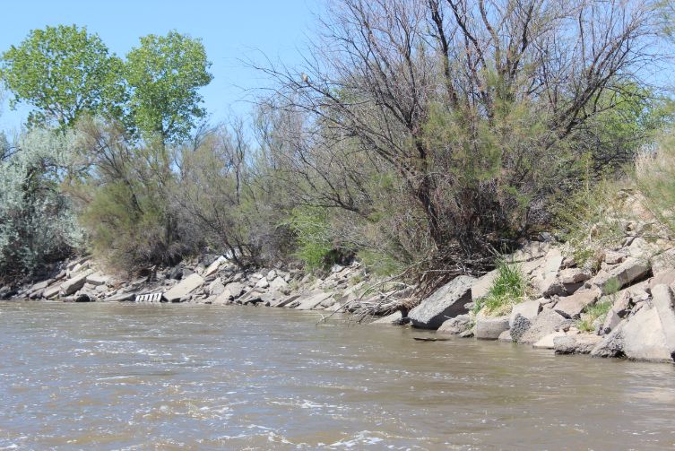
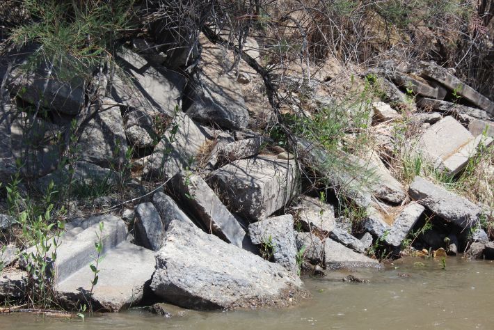
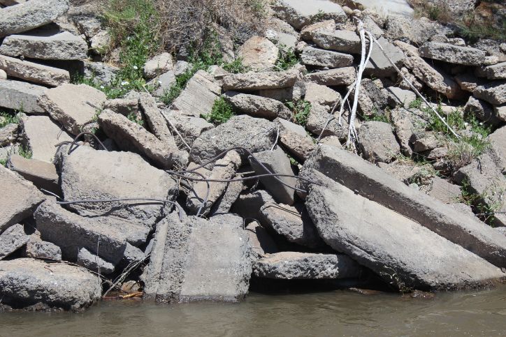
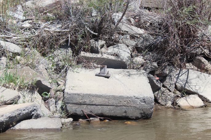
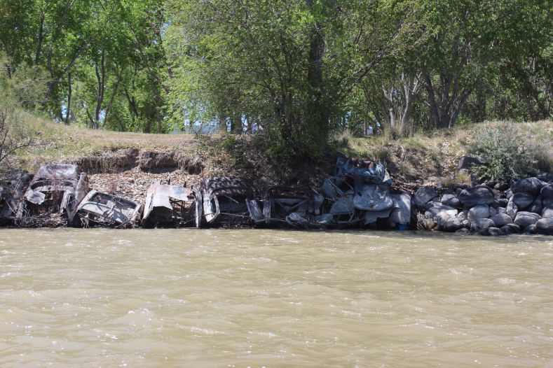
The banks are lined with rebar laden concrete just above the 29 Rd Wave as well as old cars lining the bank at the confluence with the Gunnison River. There are a few more places along the way. The hope is that someday we can get this all cleaned up. Most of this was dumped here long before people were running the river.

A few water falls can be seen in the spring time.
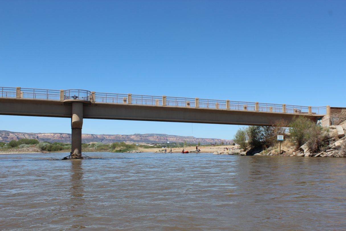
Pedestrian bridge just before the Las Coloias takeout.

Many different groups use the river throughout the year.

A family out for a great time on the water on a warm spring day.
Flow:
The gauges in the Beta Box above indicate the flow both above the confluence with the Gunnison and the flow at State Line. Neither one really tells the whole story as there are diversions for irrigation and places where the ditches flows back into the river. Try not to over think it too much and just use these as indicators of whether the river is at a low, medium, or high flow and just enjoy the river.
Every year around August it seams as though a lot of people are talking about there not being enough water to float anymore and somehow in October I still have my boat on the water somewhere. Some of my friends are even running in January, nut balls. There is always enough water on the Colorado River to float down it’s just a matter of how many beers per stretch you will be able to get in. The stretch from Corn Lake to Las Colonias is about one and a half beers in late May, but that same stretch is about 8 beers in September.

Water sports are inherently dangerous sports in which severe injuries or death may occur.
Do not use this website or maps unless you are an expert, have sought out and obtained qualified professional instruction or guidance, are knowledgeable about the risks involved, and are willing to assume personal responsibility for the risks associated with these activities. If you have any doubts in your ability please stay off the water.
DO NOT USE THIS WEBSITE OR MAPS UNLESS YOU ARE WILLING TO ASSUME PERSONAL RESPONSIBILITY FOR THE RISKS ASSOCIATED WITH THE ACTIVITIES DESCRIBED OR DEPICTED!!!