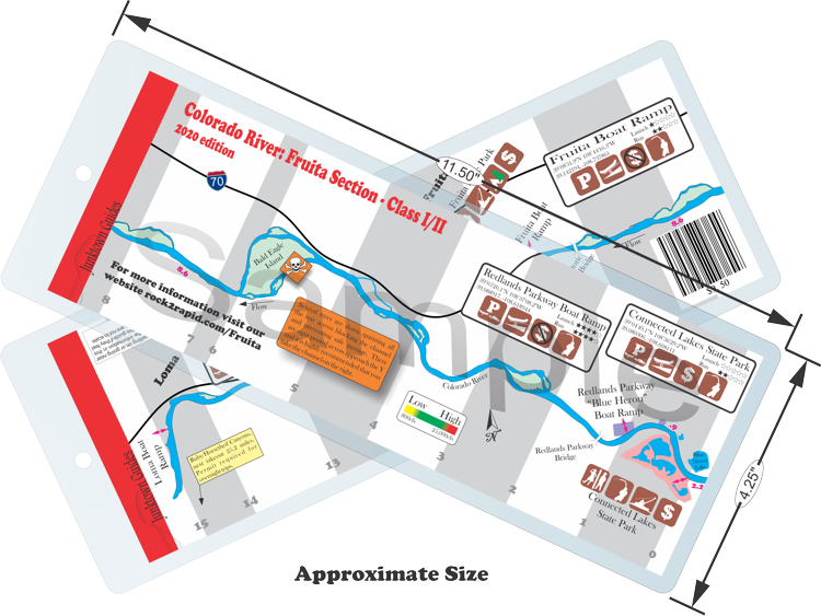
Fruita
Town Float
Difficulty:
Class I/II
Craft:
Raft
Ducky
Kayak
SUP Board
Canoe
Elevation:
Put in – 4,527ft
Takeout – 4,460ft
Length:
15 miles
This regular size map covers approximately 15 river miles on the Colorado River in the Grand Valley.
This is one of the more beautiful runs in the Grand Valley as it has a more natural feeling where you still see a few houses and farms but it doesn’t feel like you’re in the middle of a city like the GJ Town Run. The stretch between Blue Heron and Fruita is the longest stretch without a legal public access point in the Grand Valley making it the most committed. That said there is pretty good cell reception and the river does come close to Interstate 70 for a few miles about half way down so if there were an emergency you could still get help relatively quickly.
Bald Eagle Island is home of an eagle nest that isn’t inhabited every year but when they are there you can often see them hunting for fish on the river. I volunteer with Team River Runner and we often use the Town Float for teaching. One trip a few years ago, while I was in the middle of my divorce, we were floating down this stretch of river and there was one of the bald eagles sitting in a tree looking out over the river. I sat back in my kayak, looked around at the veterans I was teaching to kayak, some on their first trip, and thought “you know, life isn’t so bad”.
The Wall, a rapid at the far end of Bald Eagle Island, where the two channels converge, is the most challenging part of the run at lower flows. At water levels above 8k CFS its gets flushed but I’ve seen kayaks flip here at lower water so be careful. I’ve found the trick is to point my nose at the wall and back paddle while the current pulls me around the bend. The left channel around the island has had some trees spanning the entire way across making safe passage all but impossible. It is highly recommended that you take the right channel to be safe, there are signs leading up to the Y to warn you to go right. I hope someday we can get the hazards removed as there is a fun wave train in the channel that would be nice to run once again.
Historic Fruita Bridge:
It’s hard to imagine a time when crossing the river was no simple task but up until 1907 the only way across the Colorado River (or Grand River at the time) in Fruita was by a makeshift ferry. We’re not talking a motorized ferry like you see hauling cars across Lake Superior or the San Francisco Bay. This was likely a flat wood raft that was pulled across the river by a rope that was strung from shore to shore or something similar. Other than the ferry, the only way to cross was to head to GJ and cross the 5th street bridge, built in 1886, then trek across the Redlands back to Fruita. This was in a time before cars so it was done by horse or by walking.
The first people to really spend a lot of time on the south side of the river besides ranchers and farmers were the paleontologist digging for bones at places like Dinosaur Hill and Rigs Hill. In 1907 The Historic Fruita Bridge was built, designed by well-known engineer M.J. Patterson (this is not the same Patterson that F Rd was named after). This three span through truss bridge was the primary bridge used by Fuita residents until 1970 when the road was redirected and the Hwy 340 bridge was built.
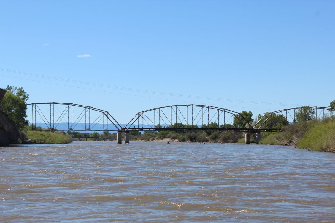
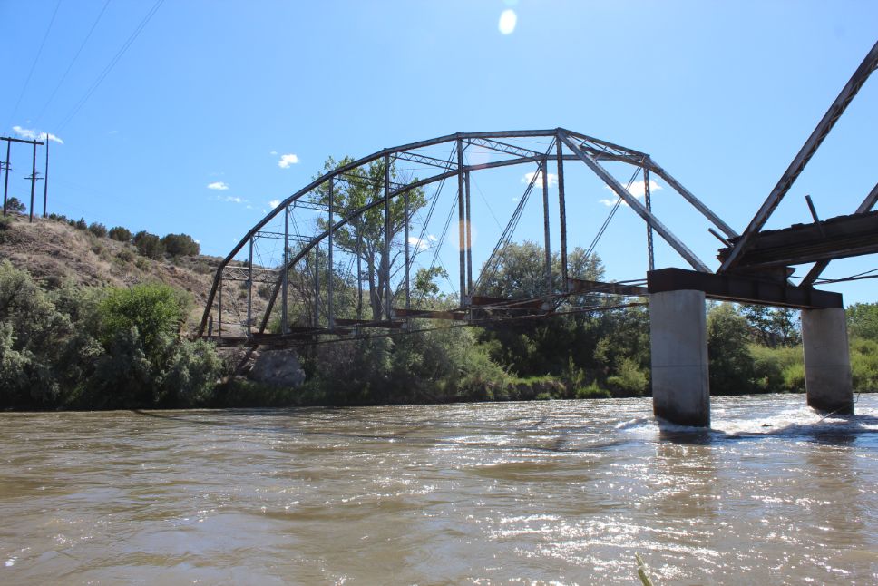
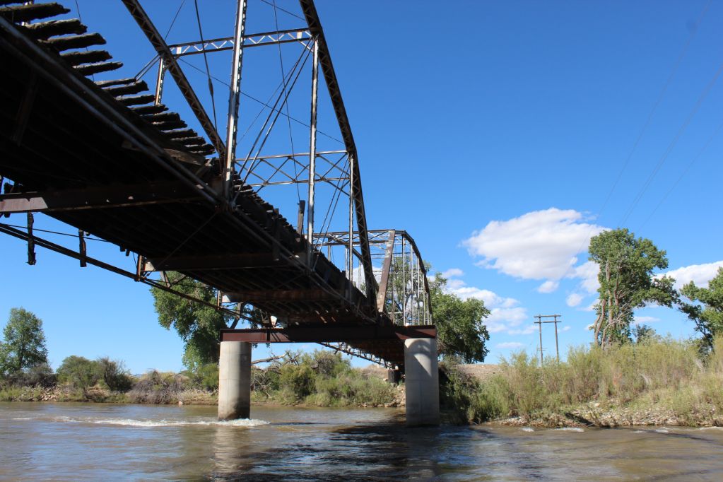
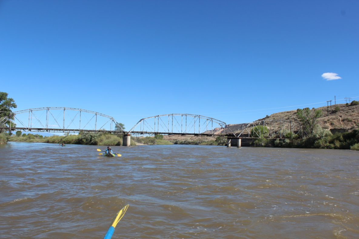
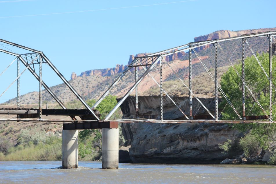
With the redirection of the road and building of the new bridge, the old Fruita bridge was still used for a while till it started to dilapidate. The wood planks that one traveled on caught fire at some point, most likely because of arson, and the bridge was eventually condemned. A survey of the bridge in the early 2000s found that one of the bridge abutments was badly eroded due to the recession of one of the river islands and it was designated for demolition. A public outcry had the city of Fruita thinking twice about it though. Instead money was raised, including a $200,000 grant from the State Historical Fund, and the abutment was repaired and plans were made to completely revamp the entire bridge to bring it up to code and make it safe as a pedestrian/bike bridge once again. As of early 2020 the money for the entire restoration has yet to come about so the bridge just sits. For now, the immediate threat of the bridge collapsing has been abated and the bridge is now a historical land mark protecting it from being torn down in the future.

Water sports are inherently dangerous sports in which severe injuries or death may occur.
Do not use this website or maps unless you are an expert, have sought out and obtained qualified professional instruction or guidance, are knowledgeable about the risks involved, and are willing to assume personal responsibility for the risks associated with these activities. If you have any doubts in your ability please stay off the water.
DO NOT USE THIS WEBSITE OR MAPS UNLESS YOU ARE WILLING TO ASSUME PERSONAL RESPONSIBILITY FOR THE RISKS ASSOCIATED WITH THE ACTIVITIES DESCRIBED OR DEPICTED!!!