Plateau
Creek
Difficulty:
Class III/IV
Craft:
Raft 9ft or smaller
Ducky
Kayak
Upper Section:
SUP Board
Canoe
Elevation:
Put in – 5,099ft
Takeout – 4,821ft
Length:
8.2 miles
Season:
This regular size map covers approximately 8 river miles on Plateau Creek as it comes into the Colorado River.
This creek has a really short season and depends entirely on the snowpack and melt cycles of the Grand Mesa. Some years are really good and the higher flow last several weeks and sometimes it doesn’t come up at all. The creek has to break a minimum of 300cfs to really be runnable and most of the year it has about 90cfs. During the spring runoff as the snow melts the level fluctuates throughout the day so if you’re looking the flow up on an app or website make sure you look at the last 24 hrs to see what the flow is doing.
Plateau Creek is one of the best advanced beginner runs close to The Grand Valley for anyone looking to get into whitewater. Too narrow for a raft over 9 or 10 feet this creek is better for kayaks, SUPs, and other small craft. There are a lot of opportunities for a newer boater to work on skills though the eddies can be small to non-existent making it challenging to take a break. Closer to 300cfs the flow is supper mellow but as you get up around 1,000 or more it can get really pushy and you will need to be on your game. Beginners should really consider passing on this run when it gets over 800 or 900cfs.

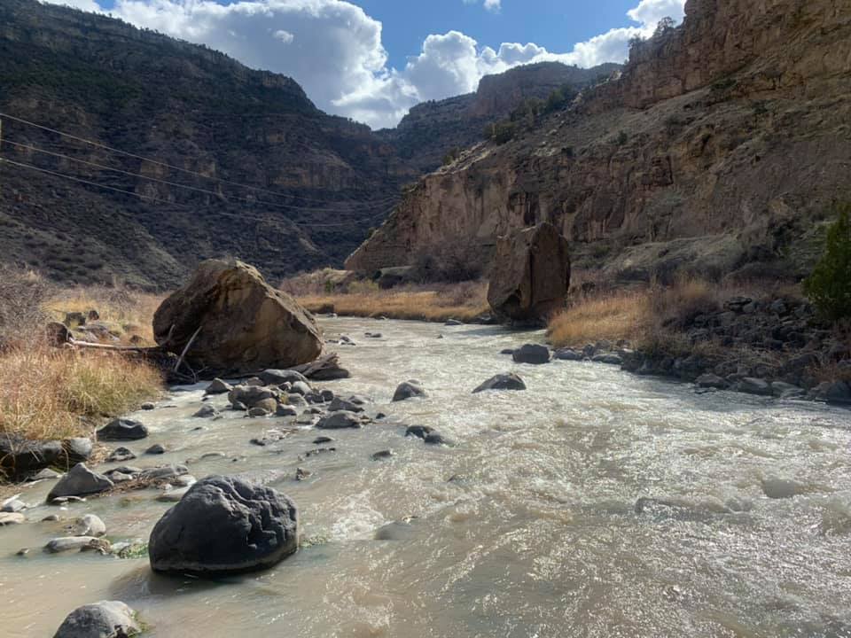
The last half mile before the final takeout is not beginner territory but it sure is a lot of fun for the more experienced. It can be fun to run laps if you can con a friend into running shuttles or with a team of 3 or more you could take turns sitting out a lap to shuttle everyone. Scouting this lower section is highly recommended since trees and other debris can get hung up through here. There are two turnouts for scouting but it might be a good idea to walk the whole stretch, especially early season when everything’s getting flushed. I’m not sure even a 9ft raft would fit through the last half mile but I’ve never tried, I would definitely scout the entire section before attempting.
Much of this creek flows through private property and while the creek is much longer than what is represented on our map the section above is often laced with barbwire to keep livestock at bay. People used to regularly put on the river at the bridge over the creek near the Colburn Cutoff but reports of barbwire across the river have been reported down from there in the last few years. This is farm country and the farmers are trying to keep their livestock safe, and on their property, for the most part. Perhaps in the future as a collective group of boaters we can negotiate the removal of the barbwire, at least for the spring runoff, but for now just try to enjoy what we have.
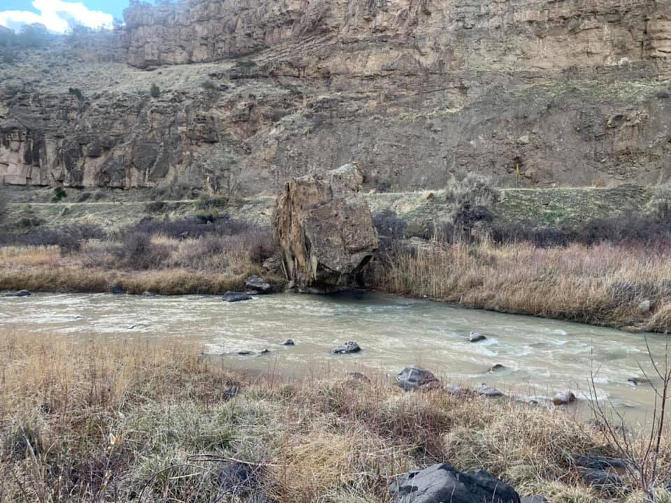
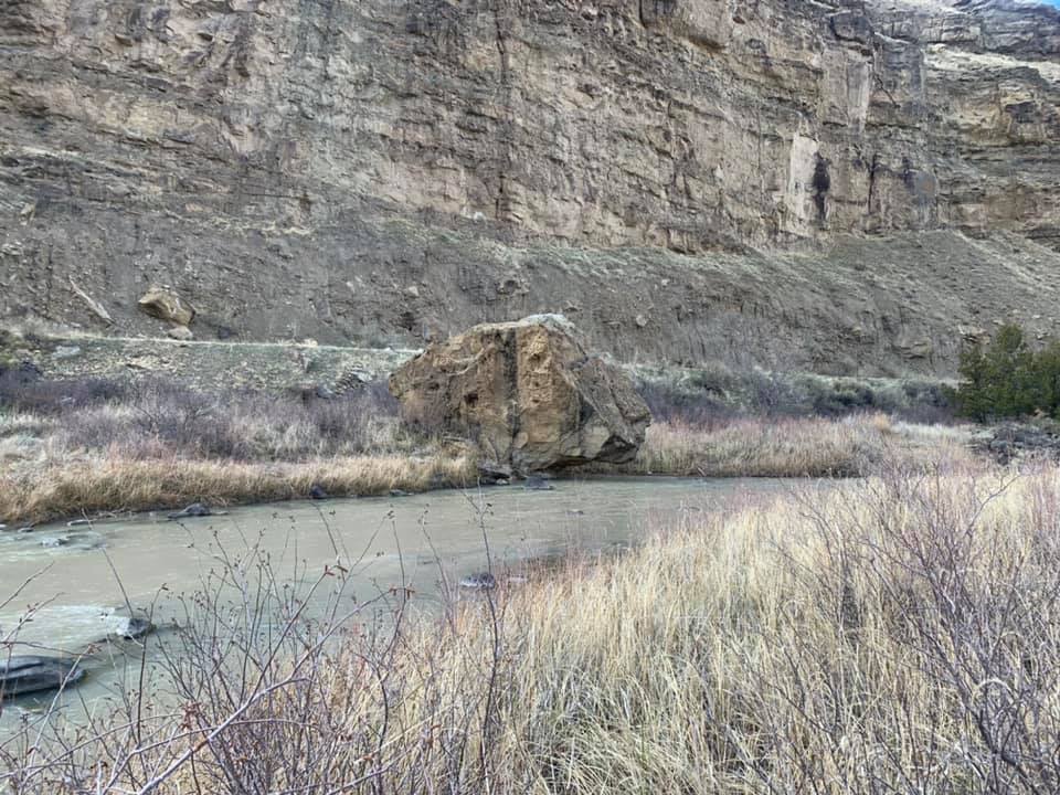
While it is easy to avoid there is a giant undercut on river right just after you go under the hwy 65 bridge in the last half mile. These pictures are of the rock at low water, at higher flows that undercut is underwater and very dangerous, you should avoid it. The island where the potential class IV lies is shortly after this undercut where there is an island in the middle of the river. Trees and other debris are often stacked up on the island making for another hazzard.

Water sports are inherently dangerous sports in which severe injuries or death may occur.
Do not use this website or maps unless you are an expert, have sought out and obtained qualified professional instruction or guidance, are knowledgeable about the risks involved, and are willing to assume personal responsibility for the risks associated with these activities. If you have any doubts in your ability please stay off the water.
DO NOT USE THIS WEBSITE OR MAPS UNLESS YOU ARE WILLING TO ASSUME PERSONAL RESPONSIBILITY FOR THE RISKS ASSOCIATED WITH THE ACTIVITIES DESCRIBED OR DEPICTED!!!