Grand Valley
Town Float
Difficulty:
Class I/III
Craft:
Raft
Ducky
Kayak
SUP Board
Canoe
Elevation:
Put in – 4,460ft
Takeout – 4,728ft
Length:
34.4 miles
This large size map covers the same stretch of river as the three listed at the bottom of this page, however it is not as pocket sized as the other three maps.
For more details on each individual stretch click on the map cards at the bottom of this page.
As the Colorado exits the De Beque Canyon it enters the Grand Valley and continues on for the next 34 miles before entering Horsethief Canyon on it’s way into Utah. Most of the river through here is pretty mellow most of the year though we do have at least one rapid most of the year and two others that come in at different flows.
Grand Junction and The Grand Valley have been a hub for the booms and busts of the region for over 100 years. From gold, silver, coal and other mining in the mid to late 1800s, to sugar beets and other farming around WWI, to uranium mining and processing from WWII till the mid-1950s, to oil and gas that continues to boom and bust in the area to this day. This area has had its share of great times and horrible times. Though it has jumped and dropped several times over the years the average population has grown with the number of people staying after a bust usually being higher than it was before the boom. The area has morphed from the wild place it once was to the metropolis it is today. As the area grew, the property along the river was developed first and in time expanded across the valley. Farms, rock quarries, the railroad, uranium mill tailing sites, sugar beet processing facilities and other private ventures lined the river through the valley till eventually there was no public access to the river.
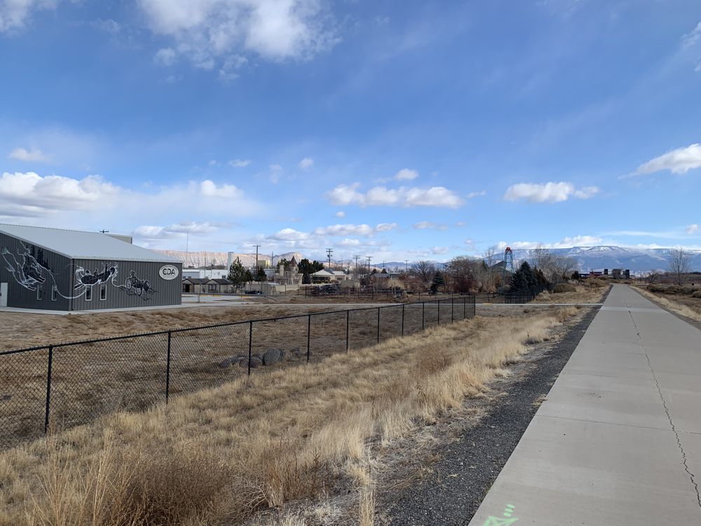
River Front Trail coming into Las Colonias River Park
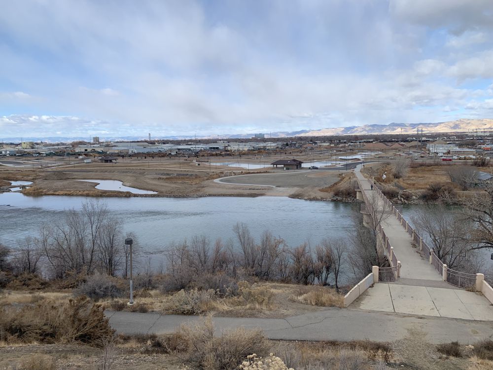
View from Eagal Rim Park overlooking Las Colonias.
Public Access to Our Rivers:
In 1987 the Colorado Riverfront Commission formed. Getting together with the cities of Grand Junction, Palisade, and Fruita along with Mesa County and the State Parks System they have been working towards providing public access to our river corridor throughout The Grand Valley. Old rock quarries, that filled with water seeping through the ground from the river, created several small lakes. The Colorado State Parks System acquired several of them and created the James M Robb State Parks in 1994 creating boat ramps to access the river and lakes for the general public to fish and recreate in. The Cities of Grand Junction and Palisade have turned some river front property into city parks and built ramps to get on and off the river at places like Palisade Rim, River Bend Park, Blue Heron, and a few more.
Construction on a river front trail that will eventually connect Palisade to Loma was started and much of it has been completed. Since its inception, the commission has facilitated the purchase of property, negotiated easements and raised public awareness of this great resource. Several large sections of this trail have been completed and several shorter trails have been built leading to places like Connected Lakes and other public lands. Enough of the trail is completed that one could ride a bike or walk from Las Colonias all the way to Loma, about 20 miles away, almost entirely without getting on a city street. Sections have been built in pieces going from Las Colonias to Palisade and the River Front Commission is in constant negotiations with the few property owners that are holding out. For more information or to help out head to their website.
Las Colonias and the upcoming Dos Rios further the commitment the City of Grand Junction has made to its open spaces turning these old Super Fund sites into public areas that combine work and play in a way that reminds people that it is just as important to support your household as it is to rejuvenate your soul.
Erosion:
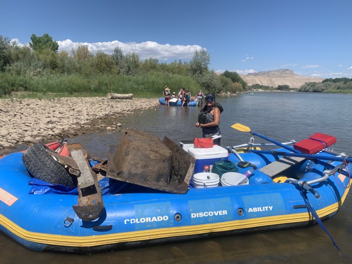
As the river winds through the valley it slowly erodes away at its banks, as rivers have always done. It’s one of the main processes by which this great landscape was formed. But, once you claim a plot of land, and more land is difficult to acquire, it must be hard to watch that land slowly falling off into the river and do nothing to stop it. Some property owners tried to take steps to slow the process by dumping rebar laden concrete, planting tamarisk or other invasive trees, and sometimes even lining the banks with old cars. This was in a time before the EPA existed or the long-term impact was widely accepted or cared about. Remnants of this can still be found up and down the river, though several local groups have been making efforts to clean it up. Organizations like the Tamarisk Coalition, now known as Rivers Edge West, have been working to remove tamarisk, and other invasive trees from the river banks and other groups have been working to clean up some of the other debris. There is still a long way to go but at least an effort is being made.
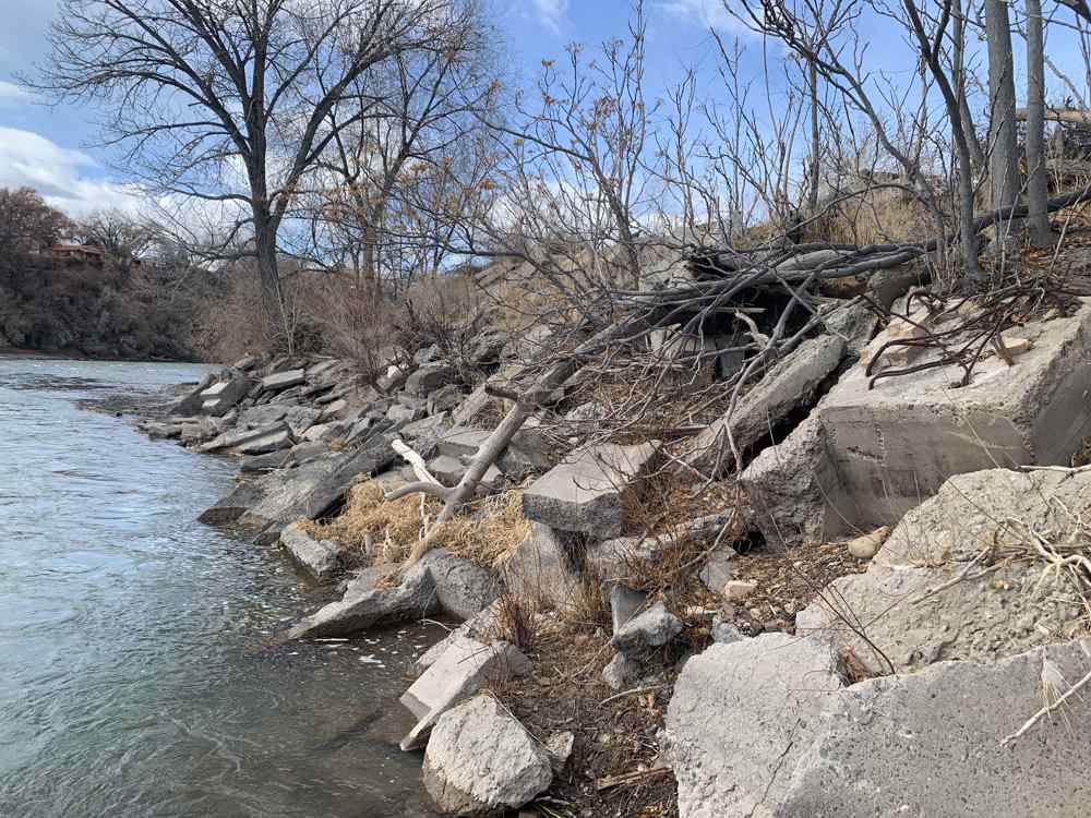
Rebar Laden Concrete at Watson Island, Las Colonias
River Clean up:
Humans can be slobs, trash and debris often get dumped or flushed into the river making it gross. Not all humans are slobs though and since 2004 local river rats have taken to the river at least once a year to do a big river clean up. This cleanup has been organized by a few different groups over the years with the latest organization to head it up being the Grand Valley Paddle Club. This continuing effort may be never ending, in 2019 75 volunteers, in 3 groups, picked up 18 yards of trash from 30 miles of river, through The Grand Valley from Palisade to Fruita. It can be discouraging to look at 15 years of river clean up and still see that much trash pulled out but it is encouraging to see locals come and care for this resource year after year. It’s a reminder that we need to be ever vigilant in our efforts to care for and maintain our beautiful places, it’s also a reminder to land managers of how important these places are to the people that use them.
Flow:
The gauges in the Beta Box above indicate the flow both above the confluence with the Gunnison and the flow at State Line. Neither one really tells the whole story as there are diversions for irrigation and places where the ditches flows back into the river. Try not to over think it too much and just use these as indicators of whether the river is at a low, medium, or high flow and just enjoy the river.
Every year around August it seams as though a lot of people are talking about there not being enough water to float anymore and somehow in October I still have my boat on the water somewhere. Some of my friends are even running in January, nut balls. There is always enough water on the Colorado River to float down it’s just a matter of how many beers per stretch you will be able to get in. The stretch from Corn Lake to Las Colonias is about one and a half beers in late May, but that same stretch is about 8 beers in September.
Class I/II my ass
I have long believed that the Colorado River through the Grand Valley is the most dangerous stretch of class I/II water that I have personally ever run. I’m not saying it’s the most dangerous I’ve ever run but while it is class I/II most of the year, at high water it becomes class IV maybe even V and not because of the rapids or technical aspect but the danger; the grade or classification of a river reflects both the technical difficulty and the danger associated with a rapid or stretch of river. There are real hazards on this stretch and the harm they cause is evident in the number of calls the Mesa County SAR get during spring runoff and the death toll that rises year after year. An article published in May 2019, the Grand Junction Daily Sentinel reported that 11 people have died from boating accidents on this river in the previous 8 years. Every river has its dangers and I’m not trying to imply that this river has some sort of special hazard not present anywhere else but I think it important to continue to have this conversation so people continue to understand the hazards present and prepare accordingly.
Please be safe out there and always:
Wear a properly fitted PFD (life jacket)
Use equipment designed for the river
Have all your safety gear and patch kits with you and in proper working order
Watch out for hazards like strainers, rebar, farm equipment and other debris
Stay within your skill level
Let people know where you will be and an approximate time you should be getting off
Avoid excessive drinking or drug use
For more information on the runs on the river please go to the individual pages for each section.

Palisade Town Float

Grand Junction Town Float

Fruita Town Float

Water sports are inherently dangerous sports in which severe injuries or death may occur.
Do not use this website or maps unless you are an expert, have sought out and obtained qualified professional instruction or guidance, are knowledgeable about the risks involved, and are willing to assume personal responsibility for the risks associated with these activities. If you have any doubts in your ability please stay off the water.
DO NOT USE THIS WEBSITE OR MAPS UNLESS YOU ARE WILLING TO ASSUME PERSONAL RESPONSIBILITY FOR THE RISKS ASSOCIATED WITH THE ACTIVITIES DESCRIBED OR DEPICTED!!!