Difficulty:
Class I/II
Craft:
Raft
Ducky
Kayak
SUP Board
Canoe
Elevation:
Put in – 4,113ft
Takeout – 3,9747ft
Length:
27 miles
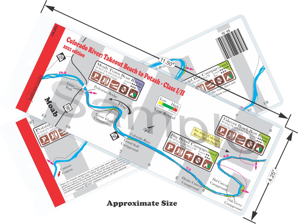
This regular size map covers approximately 27 river miles on the Colorado River in the Moab Area.
Beautiful, fun float through some dramatic landscape. This is a fun run for anyone looking to have a nice relaxing cruse. This run is all flat water with very little gradient, however the Jet boat that runs regular tours on the river can offer some waves from time to time. The official boat ramps are spread-out pretty good along this stretch but there is a road running along side the river pretty much the entire way. If you are staying at one of the campgrounds along River Road it can be a fun day float to head up stream and float back down to camp.
As you cross under the US 191 bridge you come up on the Moab Uranium Mill Tailing Remedial Action Project (UMTRAP). This is run by the Department of Energy and it is a processing area for mill tailings from the uranium mining that took place from the 1930s to the 1950s throughout this area. You can find out more details by visiting their website.

Water sports are inherently dangerous sports in which severe injuries or death may occur.
Do not use this website or maps unless you are an expert, have sought out and obtained qualified professional instruction or guidance, are knowledgeable about the risks involved, and are willing to assume personal responsibility for the risks associated with these activities. If you have any doubts in your ability please stay off the water.
DO NOT USE THIS WEBSITE OR MAPS UNLESS YOU ARE WILLING TO ASSUME PERSONAL RESPONSIBILITY FOR THE RISKS ASSOCIATED WITH THE ACTIVITIES DESCRIBED OR DEPICTED!!!

