Moab
Area
As the Colorado River crosses the border from Colorado into Utah it comes up on Westwater Canyon, a fun 18 miles stretch that cuts through some Precambrian metamorphic rock capped by deep maroon Wingate. As it continues to wind it’s way through it continues to impress as it takes you through a beautiful Western Desert landscape.
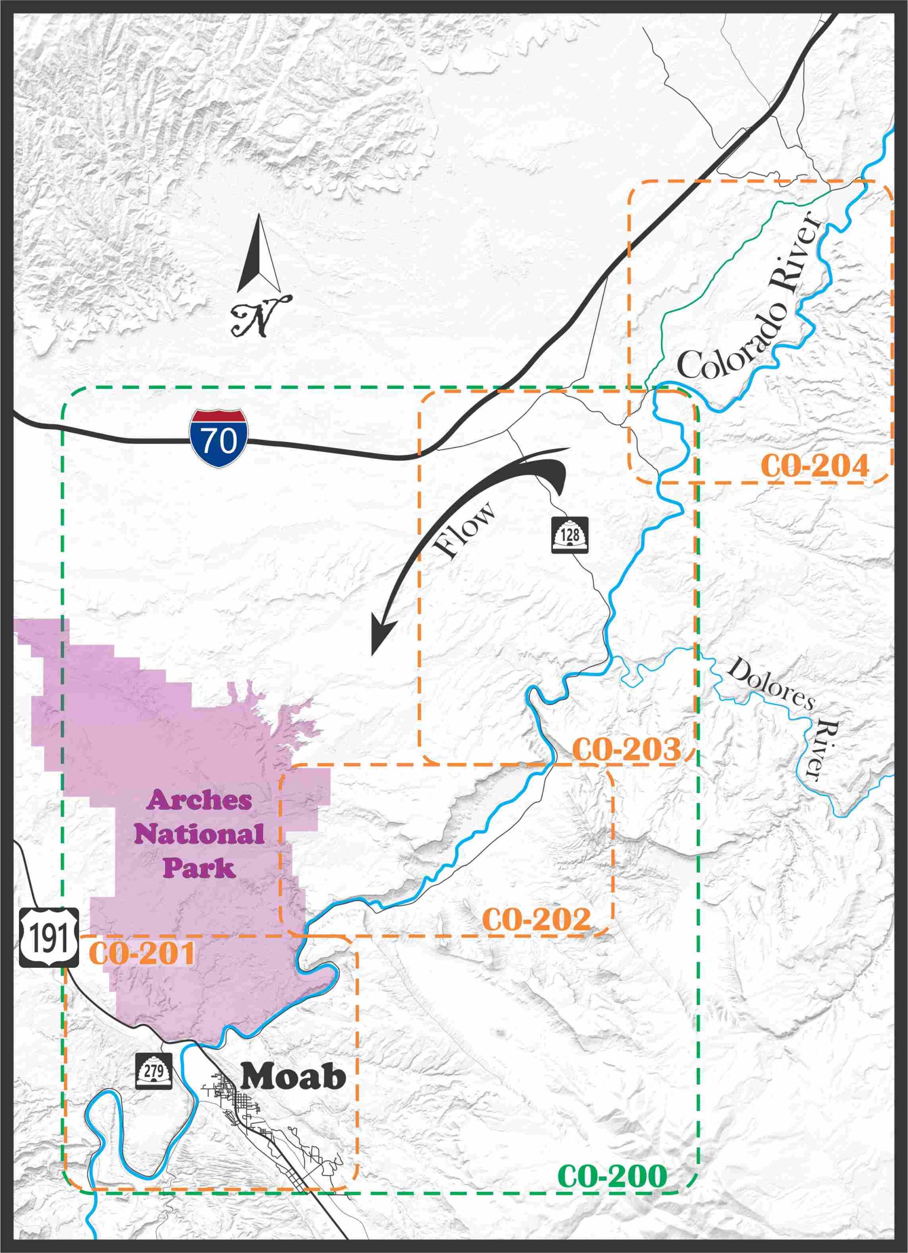
In this area we have created 5 maps to help you navigate.
Moab (CO-200): Large size map, this map covers the same stretch as the next three.
Takeout Beach to Potash (CO-201): Regular size map
Moab Daily (CO-202): Regular size map
Cisco to Hittle Bottom (CO-203): Regular size map
Westwater (CO-204): Regular size map
Moab
Takeout to Potash
Moab Daily
Cisco to Hittle Bottom
Westwater
Run
Takeout Beach to Potash
Moab Daily
Cisco to Hittle Bottom
Westwater
River
Colorado
Colorado
Colorado
Colorado
Class
I/II
III/III+
I/II
III/IV
Water sports are inherently dangerous sports in which severe injuries or death may occur.
Do not use this website or maps unless you are an expert, have sought out and obtained qualified professional instruction or guidance, are knowledgeable about the risks involved, and are willing to assume personal responsibility for the risks associated with these activities. If you have any doubts in your ability please stay off the water.
DO NOT USE THIS WEBSITE OR MAPS UNLESS YOU ARE WILLING TO ASSUME PERSONAL RESPONSIBILITY FOR THE RISKS ASSOCIATED WITH THE ACTIVITIES DESCRIBED OR DEPICTED!!!

