Grand Valley
Other Runs
Big SUR
Class: Surf Wave
Who: Everyone looking to surf
Length: Wave
Season: Spring Runoff
Gauge: above 18,000
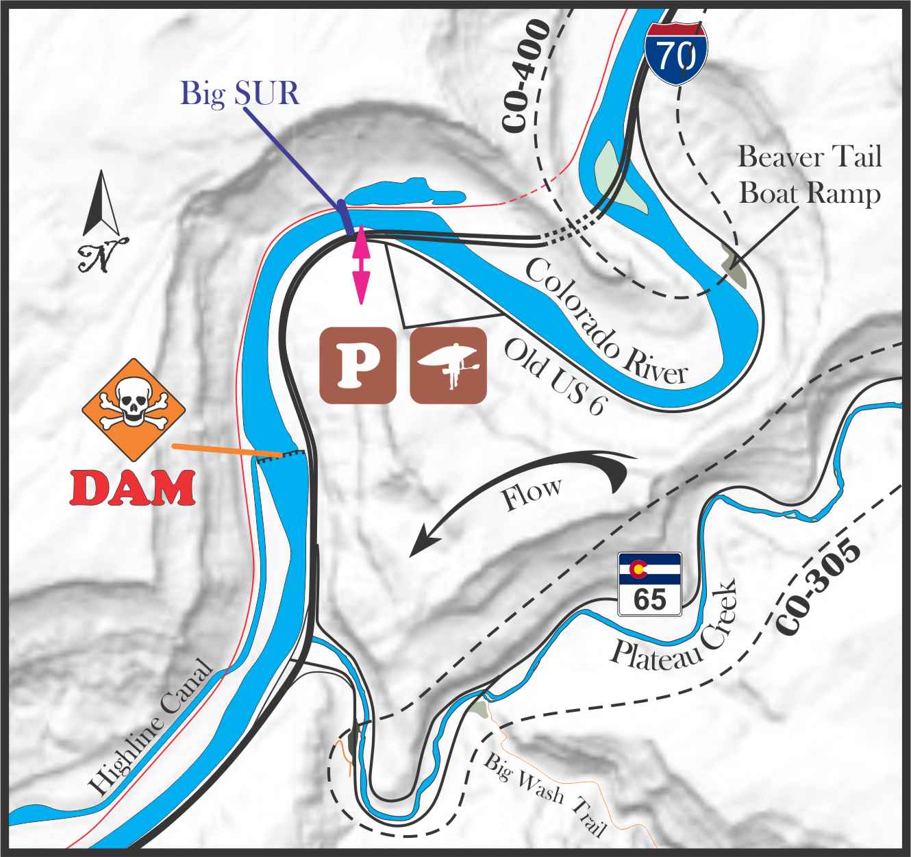
Big SUR is a river wide wave that forms because of an old man made diversion that was replaced by the dam that diverts for the Highline Canal. During the high water season the dam open one of it’s shootes to allow the runoff to flow through. Above 18,000cfs this allows enough flow to form the wave that normally isn’t there because the dam stunts the flow to an almost reservoir state.
If you come here to surf, be aware that you do not want anything to do with that dam and if you swim you have just over a 1/2 mile to get to shore. The flow is fast when this is in and it is on a banked turn that pushes you to river right. The RR tracks are on the right side and while it is unlikely that you will get a trespass charge for walking the tracks back up it is possible. If you end up on that side you will have to ferry back across to get back to your car. Long story short, hold onto your gear because if you loose it it’s a long, dangerous, and illegal walk home.

Leon Creek
Class: V?
Who: May not be runnable any more
Length: ???
Season: Spring Runoff
Gauge: Visual
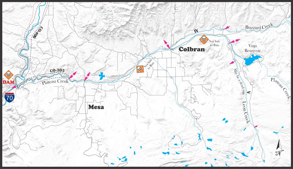
The only information I have on Leon Creek comes from the old Colorado river map that was put out in the 90s that had all of the put in and takeout’s and a general idea of the difficulty. Looking at the GIS maps it looks like the old run is completely surrounded by private property and access may be shut down permanently . I included it here for posterity.
Buzzard Creek
Class: IV
Who: those seeking an adventure run
Length: 8 miles
Season: Spring Runoff
Gauge: visual
Buzzard creek is a spring runoff adventure run. There are often river wide trees down and the entire run cuts through private property. This run is not for beginners or those looking to break into class IV, bring your A game.
Upper Plateau Creek
Class: ???
Who: Not safe to run
Length: 10-22
Season: Spring Runoff
Gauge: Visual
Many years ago it was possible to float from the town of Collbran all the way to the Colorado river on Plateau Creek. Over the years more and more fences have popped up across the river making it impassible. The river cuts through private property for pretty much the entire stretch and a story I heard was some uppity boater pissed off a land owner and it pretty much shut it down, for now.
There is also about 10-12 miles of river above Collbran as it comes out of Vega State Park. I’ve heard rumor of it being run in the past but at this point it is rumor. This stretch is also lined with private property and most of the water from Vega is diverted for irrigation so a runnable flow is rare.
.
Water sports are inherently dangerous sports in which severe injuries or death may occur.
Do not use this website or maps unless you are an expert, have sought out and obtained qualified professional instruction or guidance, are knowledgeable about the risks involved, and are willing to assume personal responsibility for the risks associated with these activities. If you have any doubts in your ability please stay off the water.
DO NOT USE THIS WEBSITE OR MAPS UNLESS YOU ARE WILLING TO ASSUME PERSONAL RESPONSIBILITY FOR THE RISKS ASSOCIATED WITH THE ACTIVITIES DESCRIBED OR DEPICTED!!!


