Ruby
Horsethief
Difficulty:
Class I/II
Craft:
Raft
Ducky
Kayak
SUP Board
Canoe
Elevation:
Put in – 4,482ft
Takeout – 4,334ft
Length:
25.2 miles
This regular size map covers approximately 22 river miles on the Colorado River in the CO/UT State line area.
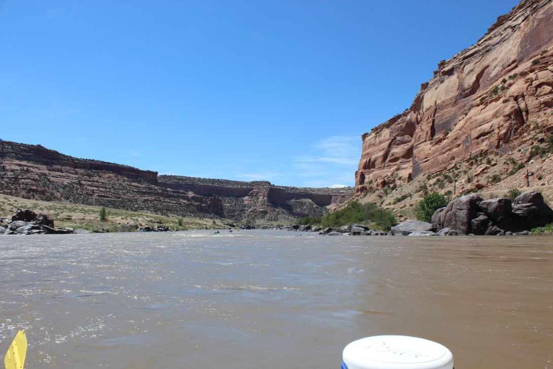
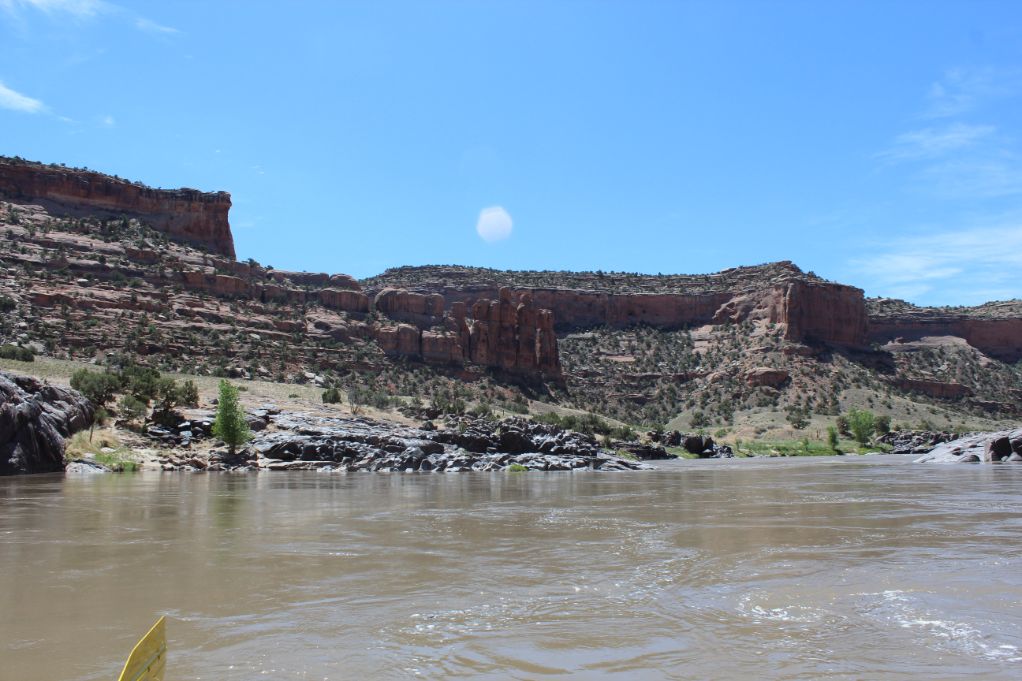
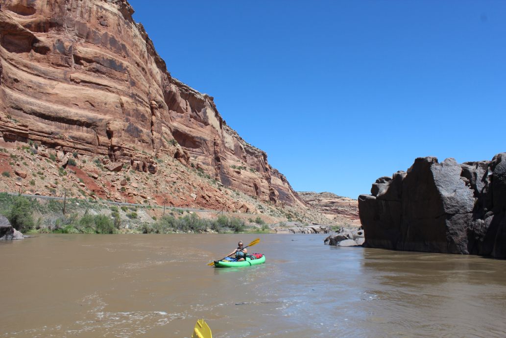
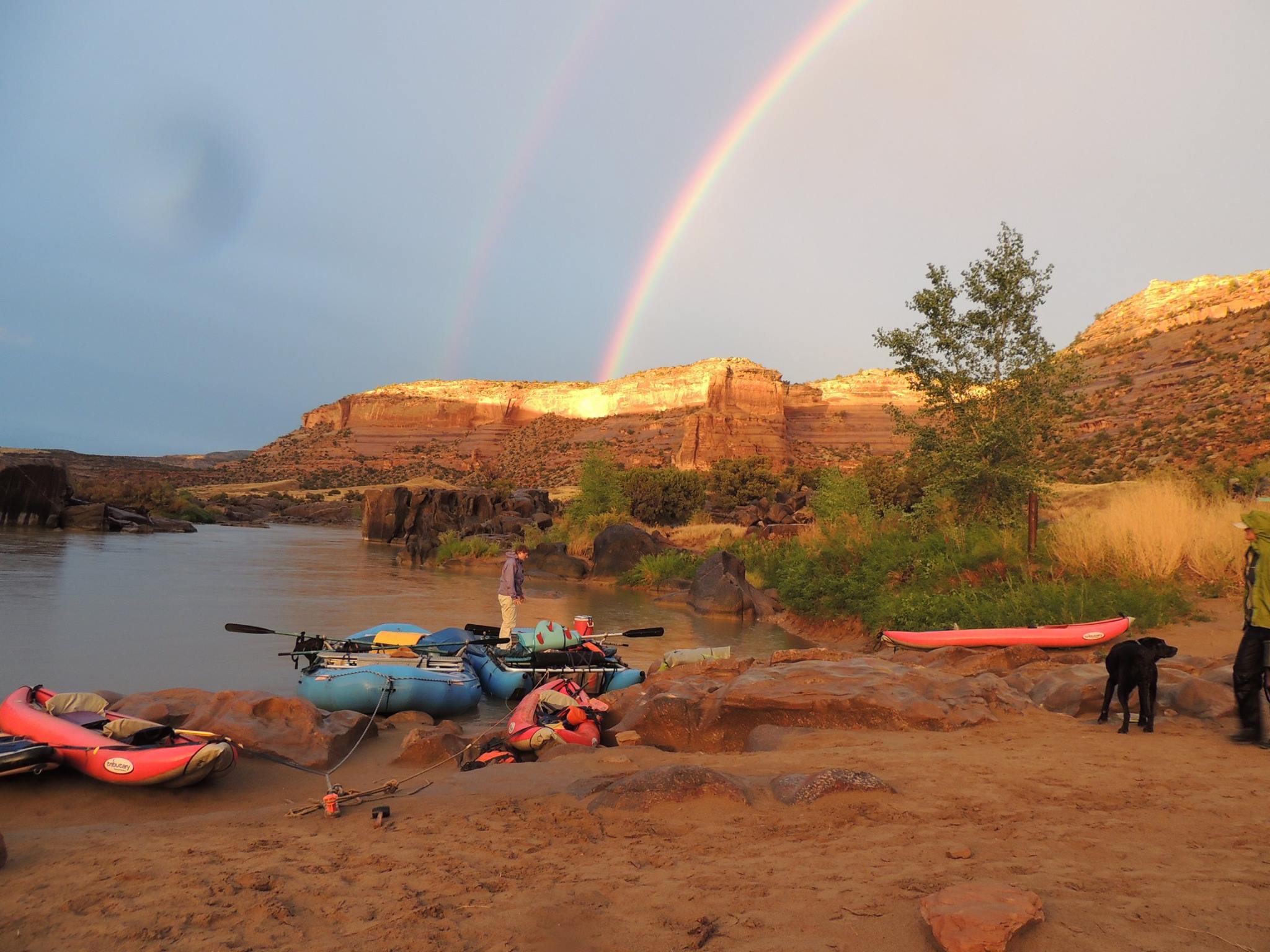
As the Colorado River leaves the state of Colorado it goes through Horsethief then Ruby Canyons as it slowly winds its way through the desert. This is where the river starts to cut through the Colorado Plateau getting some of its first red sediment on its path to the Sea of Cortez. What this run lacks in whitewater it makes up in beauty. This is one of the best mellow, family floats along the Colorado with amazing views and awesome side hikes. Given how beautiful these canyons are combined with being beginner friendly and accessible by most any watercraft, this run does get awfully crowded. Before the permit system was enacted in 2013, this stretch was overrun on weekends and holidays. Permits are only required for overnight trips but at 25 miles long this is only a day trip at really high flows. I do have friends that have done the entire float and were back drinking beer at the Copper Club by midafternoon during high-water. At lower flows this multi-day trip is a nice relaxing float through a couple of beautiful canyons with campsites that are some of the best I’ve camped at.
You can put on at the state park in Fruita which adds about 4 ½ miles to the float but offers a slightly more secured parking area though it does have a daily fee for launching and parking here. The stretch between Fruita and Loma runs adjacent to I 70 for most of it but you can hardly hear the highway.

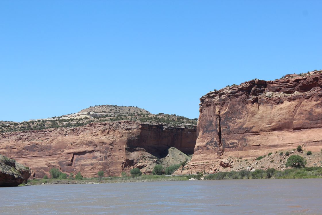
After leaving or passing the Loma Boat launch you start to enter Horsethief Canyon with steep Wingate Sandstone cliffs. A top the cliffs to the north, the Kokopelli Trail system lie with some of my favorite mountain biking in the Grand Valley. To the south is the Black Ridge Canyon Wilderness a protected area that ensures this area will stay wild for a long time to come.
As the railroad tracks start to come in from Mack you are approaching the entrance to Ruby Canyon. The tracks will follow the river all the way to Westwater from here though there isn’t too much traffic so it’s not so bad. Of the trains that do come through here, The California Zephyr is the passenger train that runs between Chicago and the San Francisco Bay Area, via Omaha, Denver, Salt Lake City, and Reno. I’m not in anyway suggesting that someone do this but it is common practice to moon the Zephyr as it rolls by, not that we condone this behavior. To the north from here is the area known as Rabbit Valley and to the south is still the Black Ridge Canyon Wilderness.
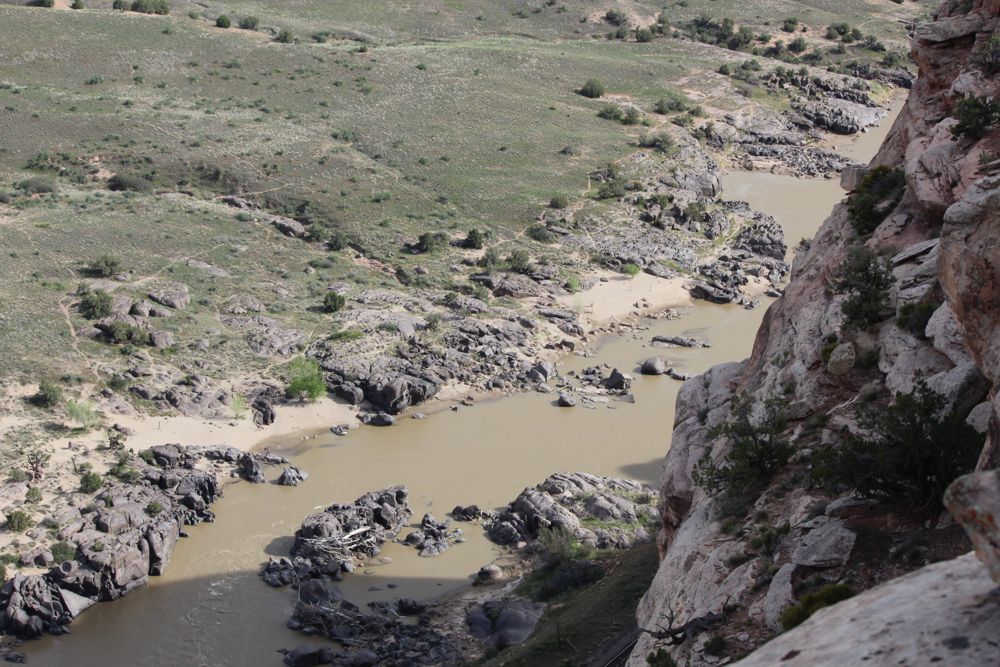
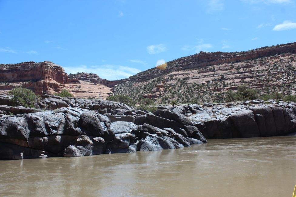
Black Rocks:
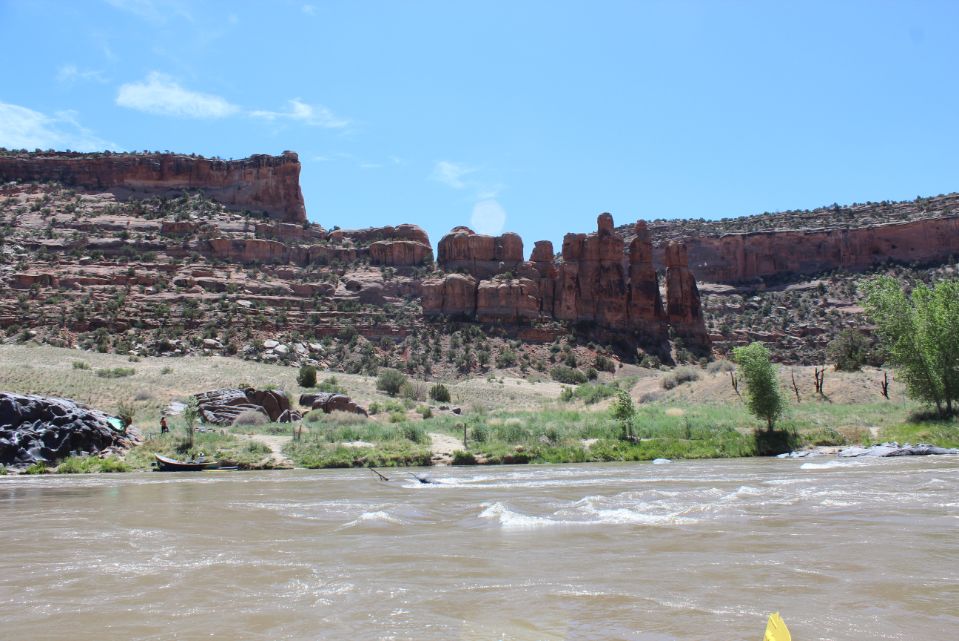
Black Rocks is the stretch of the river where some of the Precambrian rock is exposed and the river has cut some really cool runnels and made awesome formations as it exposed and shaped the rock. This rock formed about 1.7 billion years ago and is the same layer of rock that forms the Black Canyon of the Gunnison’s and Unaweep’s beautiful cliffs. These rocks create the only “rapids” of the run. At certain flows, large, big water swirlies form making it a little more challenging but at lower flows the rock is out of the water and the cool erosion features can be seen. The camp sites here are some of the most sought after so book early if you want to stay here.
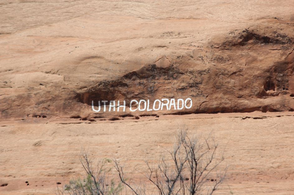
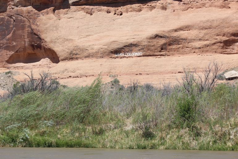
Just before you leave Ruby Canyon you’ll cross the Utah/Colorado Bourder and if you look close on river right, just over the railroad tracks, you’ll see “Utah” and “Colorado” written into the rock. About 150 yards to the west of the writing you can see some steps cut into the rock. From here it’s about 4 1/5 miles to the Westwater takeout.
Side Hikes:
Rattlesnake Arches
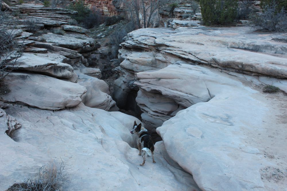
The first campground you reach is on river left at the mouth of Rattlesnake Canyon. From this campground, one could do a steep 6 1/2 mile out and back hike up to the Rattlesnake Arches, second largest collection of natural arches in the world. This is a steep hike with some rock scrambling that should only be attempted by one that feels comfortable on class III terrain. The trail is also hard to follow but the arches make it worth it. Finding the trail can be a trick and should only be attempted by those that don’t get lost easily like Brian.
Mee/Moore/Knowles Canyons
Each of the canyons on river left makes for some excellent side hikes in an area not easily accessible by other means. In a very convoluted way, Mee and Knowles can be linked into a long backpacking trip from Glade Park if one had a pack raft. Hiking up either one from the river is an enjoyable hike up beautiful canyons. Trails might be hard to find but unless you have absolutely no sense of direction, like Brian, you’ll be able to explore and make it back to your boat without too many issues. Moore Canyon is shorter than Mee or Knowles and has a more remote feeling somehow. If you stay at any of the Black Rocks campsites you should hike this canyon.
McDonald Creek Canyon
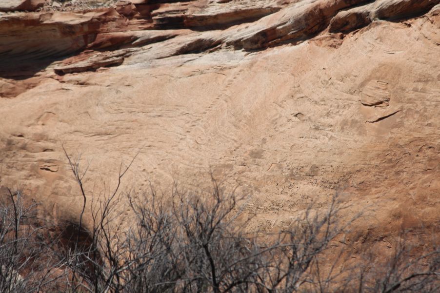
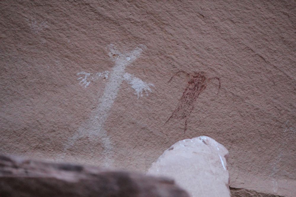
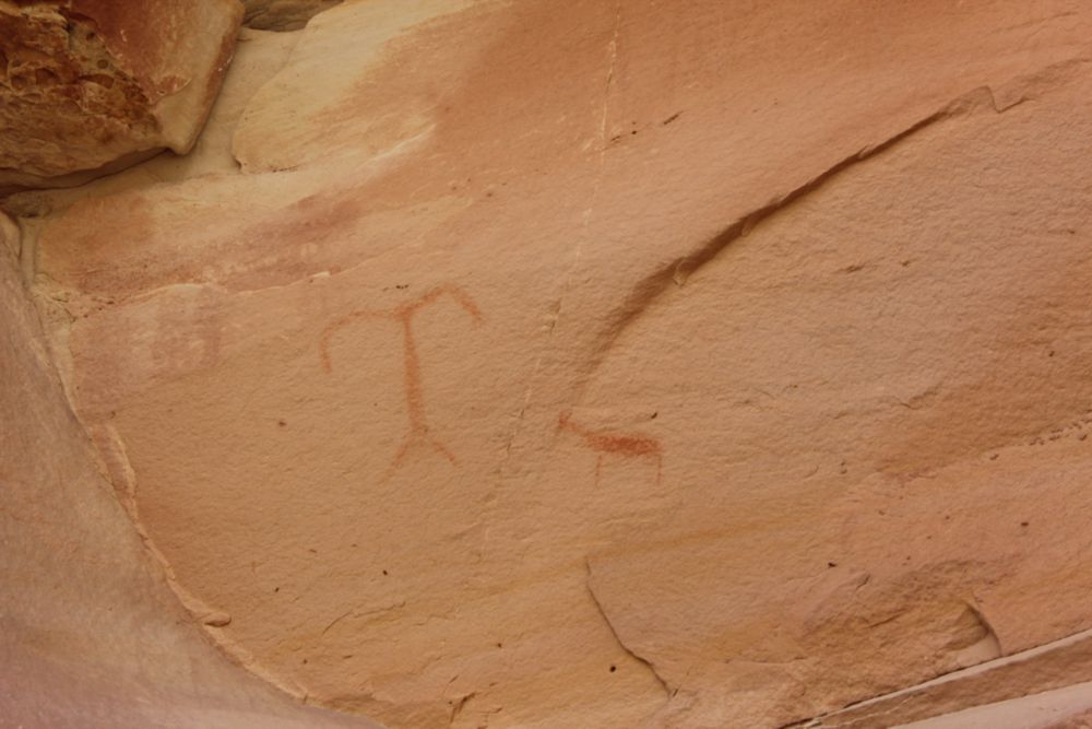
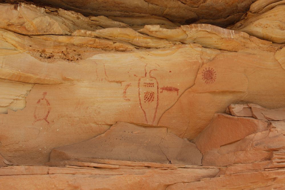
Evidence of early man visiting this area dates back to the Archaic Era. After the Archaic Era the Freemont, still a pre-Columbus tribe, roamed mostly through modern day Utah and into western Colorado. It is believed that the pictographs in this canyon come from the Freemont but it is impossible to date rock art so it’s hard to confirm. This is a popular hike to do from Rabbit Valley but you can also hike it from the river. If coming from the River you can find the first panel on the right/east side of the canyon less than ¼ mile from the river. The next two panels can be found about 1 ¼ miles up from the river. The one on the right side of the canyon is etched (petroglyph) into the soft rock and is very faint. Several people have also etched their names into the rock here. Opposite the petroglyphs, on the other side of the narrow canyon is a pictograph. About another ¼ mile from here is the last panel on the right side, probably the most impressive. If one needed, there is a pit toilet at the trailhead but otherwise I’d head back to the river from the last panel.
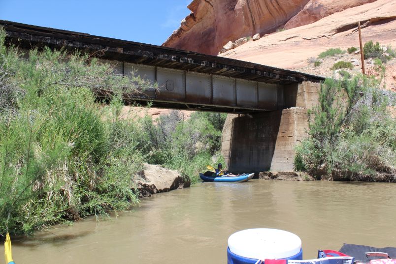
Walking over or on the railroad tracks is considarded trespasing, but there is a bridge where you can go under the tracks. At flows higher then 10k CFS exit your boat on the east side of McDonald Creek to avoid more bush whacking and crossing the creek.
Hurricane Ruby:
Like most of our desert river runs, Stacy rears her ugly head in the afternoons and blows upstream making for a pretty miserable day. Usually worse in the spring and fall, Stacy can even pick up on days where the forecast calls for clear skies. In late September 2017 the ladies’ trip put on by Colorado Discover Ability encountered Stacy in a way so memorable they all refer to it as Hurricane Ruby. Fortunately, they were almost at camp before the wall of the storm came on them but they had clients and volunteers floating along in duckies and SUP boards along with the rafts. With little warning they rounded everyone up into the rafts and rowed against the wind to get to camp then spent the next couple of hours setting up tents in the wind and rain. While this wasn’t an emergency situation it made for some exciting stories and some of the kids that were on the trip are still a little traumatized though they still join the ladies’ trip every year.

Water sports are inherently dangerous sports in which severe injuries or death may occur.
Do not use this website or maps unless you are an expert, have sought out and obtained qualified professional instruction or guidance, are knowledgeable about the risks involved, and are willing to assume personal responsibility for the risks associated with these activities. If you have any doubts in your ability please stay off the water.
DO NOT USE THIS WEBSITE OR MAPS UNLESS YOU ARE WILLING TO ASSUME PERSONAL RESPONSIBILITY FOR THE RISKS ASSOCIATED WITH THE ACTIVITIES DESCRIBED OR DEPICTED!!!