Lower
Gunny
Difficulty:
Class I/II
Craft:
Raft
Ducky
Kayak
SUP Board
Canoe
Elevation:
Put in – 4,700ft
Takeout – 4,600ft
Length:
12.4 miles
Season:
Year Round
Optimal:
May-September
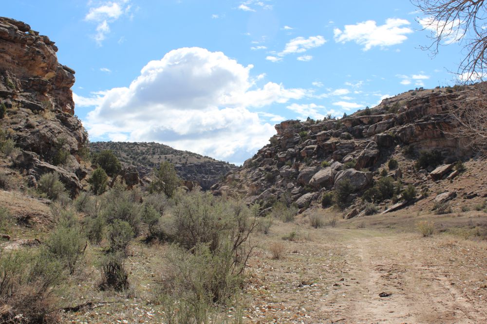
The Lower Gunny is a mellow run through a beautiful desert canyon. Despite the name of the “town” and boat launch there is no whitewater to be found here, at least not on the Gunnison, but it is a great float for those looking for an easy day on the river. It starts off floating past a few small lakes and gravel quarries before entering a small canyon with the Gunnison Bluffs and Old Spanish Trails on one side and the Bangs Canyon Special Recreation Area on the other. There are some great side hikes on river left that are not easily accessible from any trailhead that could make for some fun remote adventures.
This run isn’t done as often as other local Grand Valley floats but we believe this is because of the lack of knowledge about the run by all but the most prolific local boaters. This isn’t a whitewater experience but if you have done some of the town floats on the Colorado and enjoy that type of mellow float this could be another stretch for you to do on a lazy day off. This is a more remote experience than any of the other Grand Valley floats and the roller dam at the Redlands Canal Diversion leads us to recommend beginners stay away until they have better boat control and can hit an eddy, without fail, on moving water. Putting in below the dam and running to Blue Heron has been gaining in popularity over the last several years and is a good option for one that wants to explore over here without committing to 12+ miles in a day on the river.

Side Hikes:
The Bangs Canyon Special Recreation area is a Jeepers playground with miles upon miles of 4X4 trails that wind through the area. You won’t see any of the jeep trails from the river till you get to Rough Canyon and even on a busy weekend it is likely that you won’t see anyone on the trails, though you could.
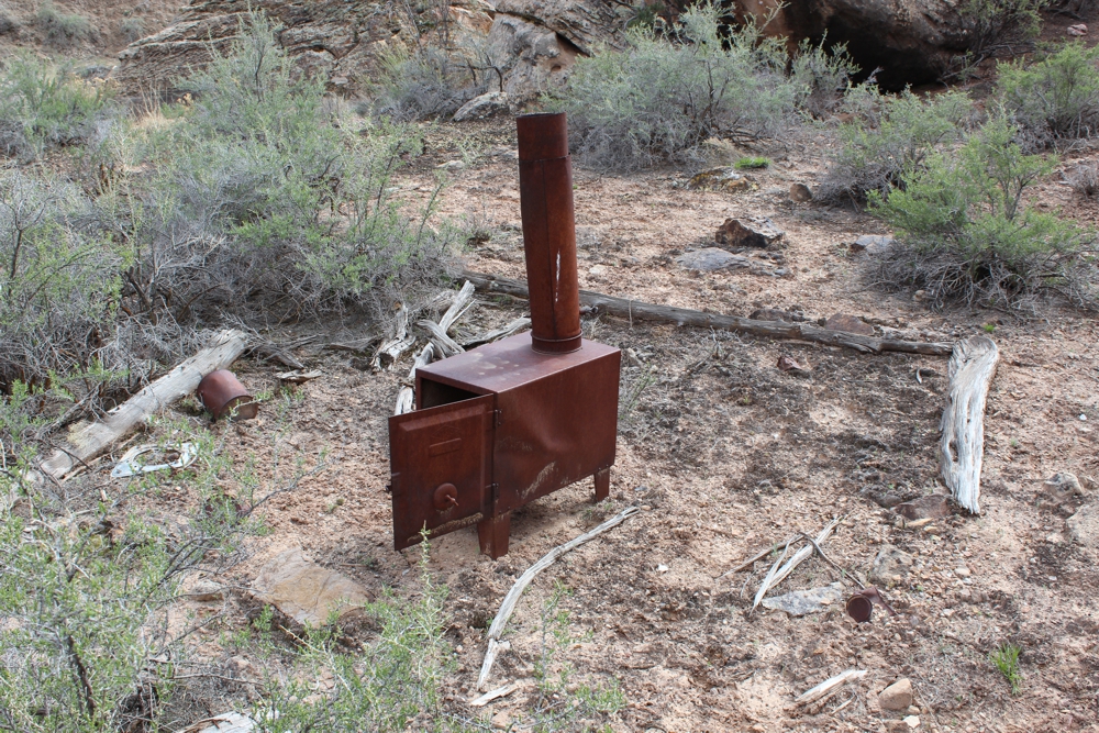
The first canyon you come to on river left is Lower Bangs Canyon. It is not easily accessible from any trailhead so it is not hiked often. It is a beautiful canyon with only a trace trail to follow but it would be hard to get lost as you are surrounded by short canyon walls. Along the trail you can find an old cowboy camp and metal stove that was likely used by local ranchers watching over their livestock. At about 3 miles from the river the canyon splits with West Bangs being the right canyon and Bangs Canyon on the left. The land mass dividing the canyon is known as Island Mesa which boasts an awesome view of the Grand Valley but it would be difficult to access from the canyon floor.
The Lower Rough Canyon is another great day hike from the river. Not to be confused with the Magellan Jeep trail that crosses the mouth of the canyon near the river, this is another trace trail that heads up a small dry canyon. This is a much less popular section of the canyon for hikers than the Upper Rough Canyon trail that is accessed from Little Park Road but is still a beautiful hike and well worth exploring for those looking for a more adventurous hike.
The railroad tracks and a short cliff make side hikes on river right all but impossible though there are a couple of places where the trails come down close to the river. That said the more scenic and harder to access by car trails are on river left. I do highly recommend the hikes on river right on another day though, I used to regularly take Aukie for day hikes after work on the Gunnison Bluffs trail to get a little exercise close to home when I lived in Orchard Mesa.
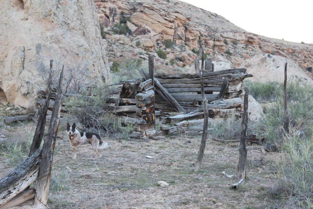
Petroglyph and Old Log Structure:
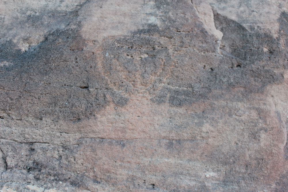
About 4 to 4.5 miles after you put on at Whitewater you can find a single petroglyph on river left about 15-20 yards from the river. It is faint and can be hard to find, look for the large boulder with the overhanging upper block (pictured right). The petroglyph will be on the south face of the boulder under the overhang. About a quarter mile downstream from here you can find the remains of a log structure that was likely built in the early 1900s. In August of 1907, Henry E. Lopas filed a mining claim patent to purchase this property. It does not appear that any actual mining happened on this property but around the turn of the century this tactic was used to buy land cheap from the federal government. According to the Mesa County GIS, it appears as though this property belongs to the US Government once again.

Water sports are inherently dangerous sports in which severe injuries or death may occur.
Do not use this website or maps unless you are an expert, have sought out and obtained qualified professional instruction or guidance, are knowledgeable about the risks involved, and are willing to assume personal responsibility for the risks associated with these activities. If you have any doubts in your ability please stay off the water.
DO NOT USE THIS WEBSITE OR MAPS UNLESS YOU ARE WILLING TO ASSUME PERSONAL RESPONSIBILITY FOR THE RISKS ASSOCIATED WITH THE ACTIVITIES DESCRIBED OR DEPICTED!!!